Questions without Answers
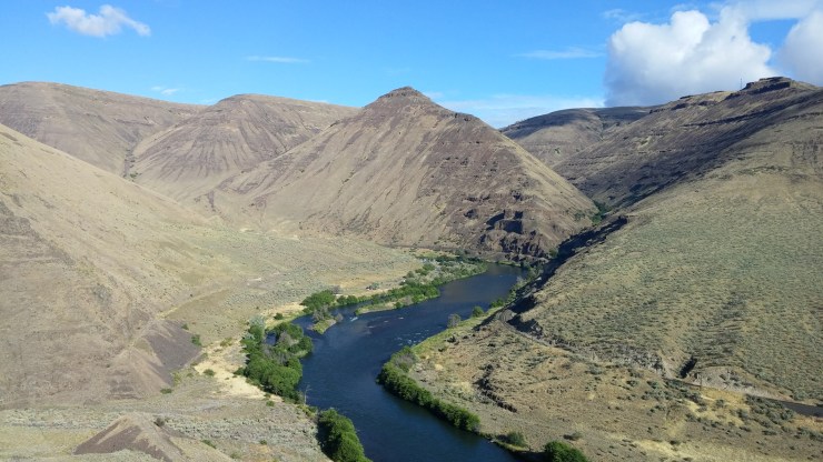
I was standing on the side of a shouldered ridge 200 feet above the river in Deschutes canyon of central Oregon. The small flakes of glassy, yellow rock at my feet had piqued my interest. In a rush, so many questions came to mind.
Was this a different variety of the same rock I had seen in Utah’s Canyonlands?
Had this shiny yellow rock been carried here by humans?
Was it used to make projectile points like the red chert my Uncle had taught me about in Utah?
Had Native Americans lived in this canyon?
It wouldn’t be until 2 years later and with the help of a drone and some high-tech software that I would find answers to my questions.
Old Tricks
Googling and Google maps
A google search answered the first couple questions. Yes, it sure looked like this rock from central OR was the same I had seen in Utah – it was chert. And, yes, there were some references to Native Americans in the vicinity. And, curiously, I found suggestions that there were remains of a Native American settlement in the form of depressions in the ground called “house-pits”. Hmm…that’s interesting!

I perused the area on google maps satellite imagery. Nothing obvious jumped out at me.
On a subsequent trip to the area I poked around on foot, but didn’t know exactly where to look and could not find any obvious house-pits. I would need more information or better tools.
Further online digging came up with a more detailed description of the location of the pits. Also, I learned that a team of archaeologists had excavated this site between 1965 and 1968 and dated the site as 6000 years old. Way cool!
But, even with this detailed info, another trip to the area proved that seeing the depressions on foot was not possible, at least not to my untrained eye. Bummer.
Then, some months later, a lightbulb moment came: Could I use a drone and photogrammetry to identify the depressions? I had a new question, and a new mission.
New Tricks
A Flying Robot and Magic SW
The first time I learned of the power of DroneDeploy and the photogrammetry technique it sounded like magic; I thought I was missing something. But, no, it’s true, a 3D model made from nothing but geo-referenced 2D images from a regular camera. Not magic, just science, geometry, and some powerful software.
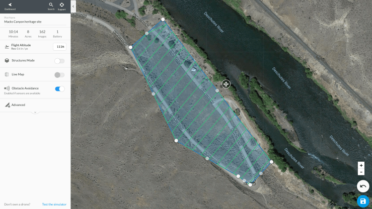
My flying-robot, a DJI Phantom 3 Pro, collected hundreds of images over an 8 acre area. I uploaded the images, and let DroneDeploy do the “magic” of making 3-dimensions from only two. Now, with this 3D model of the area, could I identify the depressions in the ground by viewing the DSM (Digital Surface Model)?
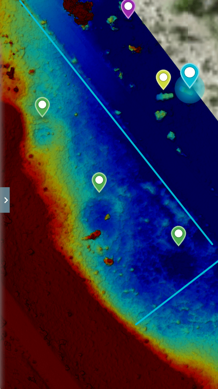
By constraining the color gradient to the narrow elevation band of interest, 3 circular depressions became apparent. I was floored! It had worked.
Even Older Tricks
University of Oregon Library


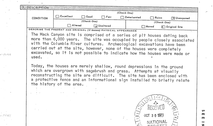
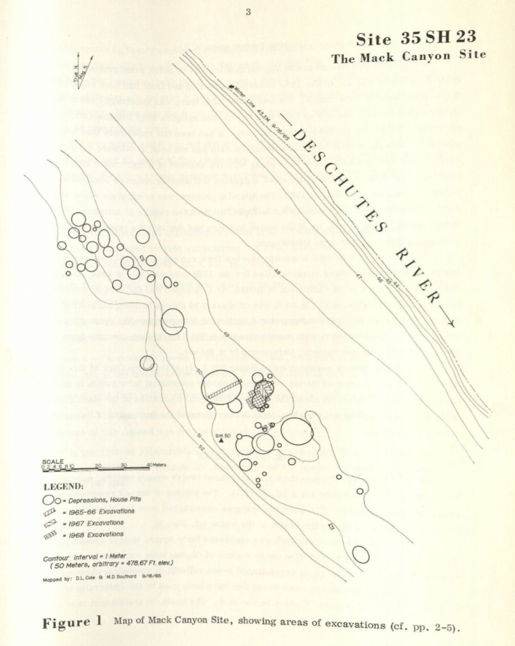
I was pretty confident with the images I had created and the depressions I had identified, but I wanted validation. I headed south from Portland to the University of Oregon (UofO) campus in Eugene in search of the archaeological reports from the 60’s. There I found the original typewriter-typed reports by David L. Cole, who had led the excavations at the Mack Canyon site in the ’60s.

The reports contained some fascinating old images of the site during excavations in the 60’s, documentation of the artifacts that were found, as well as a map documenting the depressions that were found.
When compared side-by-side, the three pits I had identified were, indeed, indicated on the map from the report. I’ll be damned!
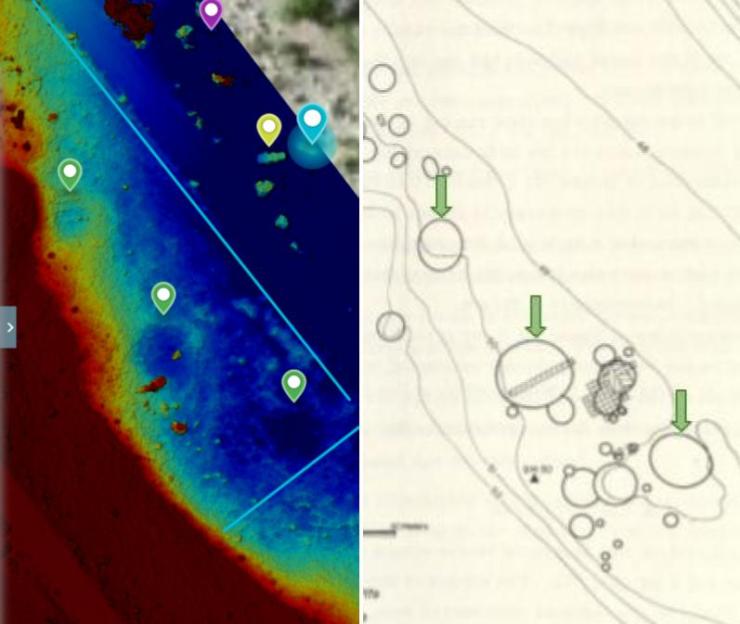
But, also, I learned that the UofO team had found 47 other depressions that I had not found with my analysis. I left this project sit at this point for quite some time; only after gaining some skills with ArcGIS, a more powerful analysis tool, did I revisit it for further analysis. Read about that in Part 2.
Sources

1 thought on “Digging Deeper with Drone Technology – Part 1”